Howdy, Stranger!
We are about to switch to a new forum software. Until then we have removed the registration on this forum.
Categories
- All Categories 25.7K
- Announcements & Guidelines 13
- Common Questions 30
- Using Processing 22.1K
- Programming Questions 12.2K
- Questions about Code 6.4K
- How To... 4.2K
- Hello Processing 72
- GLSL / Shaders 292
- Library Questions 4K
- Hardware, Integration & Other Languages 2.7K
- Kinect 668
- Arduino 1K
- Raspberry PI 188
- Questions about Modes 2K
- Android Mode 1.3K
- JavaScript Mode 413
- Python Mode 205
- Questions about Tools 100
- Espanol 5
- Developing Processing 548
- Create & Announce Libraries 211
- Create & Announce Modes 19
- Create & Announce Tools 29
- Summer of Code 2018 93
- Rails Girls Summer of Code 2017 3
- Summer of Code 2017 49
- Summer of Code 2016 4
- Summer of Code 2015 40
- Summer of Code 2014 22
- p5.js 1.6K
- p5.js Programming Questions 947
- p5.js Library Questions 315
- p5.js Development Questions 31
- General 1.4K
- Events & Opportunities 288
- General Discussion 365
In this Discussion
- tnagel July 2016
- unparadise July 2016
cf. city flows - Comparing bike sharing systems in NYC, London and Berlin
Hi,
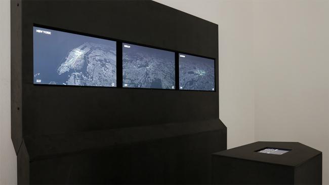
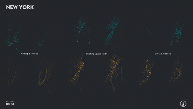
We just launched the website for our visualization cf. city flows, a visualization showing ebbs and flows of urban cycling activity. It was designed to help citizens casually analyze three bike-sharing systems in the context of a public exhibition space.

Check out more images and videos, as well as more details on the project and our design process at https://uclab.fh-potsdam.de/cf/
This is an interactive exhibit with three screens, and a controller column in center front. The three high-resolution screens show different visualization scenes for New York City, Berlin, and London. It runs on a single MacPro. Data processing, analysis and visualization was done in Processing. Geo-mapping with the help of our Unfolding Maps library.


Comments
Hi tnagel,
This is beautiful work. And thank you for developing and sharing the unfolding map library too. I started to play with the unfolding map library not too long ago. I have been try to create the map in a 3D environment but have not been able to find a way to do it. I was wondering whether you could point me to any resources that explain how to achieve this.
Thank you in advance for your time.
Unparadise
Hi unparadise,
Thank you.
You can find a very basic 2.5D map example at https://github.com/tillnagel/unfolding/blob/master/examples/de/fhpotsdam/unfolding/examples/misc/Unfolding3DMapApp.java - Note, that the current github repo uses P3, and while we haven't released Unfolding for P3 you can either clone the repo, or send me an e-mail to get a beta.
Thank you very much for your prompt response, Till. I will take a look.